


80 Precinct, Sarpy County, Nebraska
About
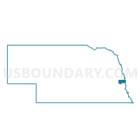
Outline

Summary
| Unique Area Identifier | 613846 |
| Name | 80 Precinct |
| County | Sarpy County |
| State | Nebraska |
| Area (square miles) | 0.70 |
| Land Area (square miles) | 0.70 |
| Water Area (square miles) | 0.00 |
| % of Land Area | 100.00 |
| % of Water Area | 0.00 |
| Latitude of the Internal Point | 41.08573140 |
| Longtitude of the Internal Point | -96.13330160 |
Maps


Graphs
Select a template below for downloading or customizing gragh for 80 Precinct, Sarpy County, Nebraska


Neighbors
Neighoring Voting District (by Name) Neighboring Voting District on the Map
- Platford Springfield 1 Precinct, Sarpy County, NE
- Platford Springfield 2 Precinct, Sarpy County, NE
- Platford Springfield 3 Precinct, Sarpy County, NE
Top 10 Neighboring County Subdivision (by Population) Neighboring County Subdivision on the Map
- Springfield precinct, Sarpy County, NE (1,529)
- Platford-Springfield I precinct, Sarpy County, NE (933)
- Platford-Springfield II precinct, Sarpy County, NE (857)